|
|
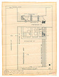
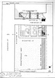
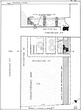
| Actual state plan of excavation on the corner of Hadrian and Thesion Streets (Panathenaic Way) ... John Travlos ... Revised from PD 1006. 81-411 81-411 Fragile Distored Dirty Faded Heavy Tracing Paper Drafting Ink ... 1958 |
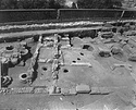
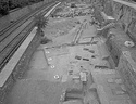
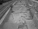
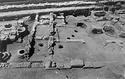
| Turkish and Byzantine walls in Trench B (Rooms 20, 21, 23, 24, 25, 26, 27, 28, 29, 30, 17, 18). In foreground Turkish level of the Panathenaic Way ... AMS south 812 Horizontal (normal) ... 12 May 1970 |
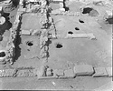
| Turkish and Byzantine walls in Trench B (Rooms 20, 21, 23, 24, 25, 26, 27, 28, 29, 30, 17, 18). In foreground, Turkish level of the Panathenaic Way ... AMS south 814 Horizontal (normal) ... 12 May 1970 |
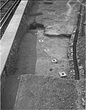
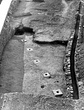
| Row of post supports (limestone square bases) across the Panathenaic Way at east end of the section ... AMS west 2786 Horizontal (normal) ... July 1973 |
| Eastern part of the section near the north bridge showing the line of limestone bases 1 to 5 ... AMS west Horizontal (normal) ... 1974 |
| Panathenaic Way just west of the northern entrance to the Agora.
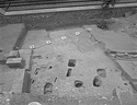
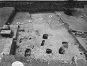
East Trench and East Extension showing the line of limestone bases 1 to 5; cobbles and road surface, and cuttings for bleachers (ikria) ... AMS 3490 Horizontal (normal) ... 1980 |
| Panathenaic Way just west of the northern entrance to the Agora.
East Trench and East Extension showing the line of limestone bases 1 to 5; cobbles and road surface, and cuttings for bleachers (ikria) ... AMS 3490 Horizontal (normal) ... 1980 |
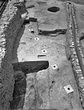
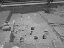
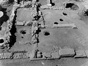
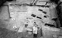
| East Trench and East Extension line of limestone bases, cobbles and road surface, and cuttings for bleachers (ikria) ... AMS 3492 Horizontal (normal) ... 1980 |
| East Trench and East Extension line of limestone bases, cobbles and road surface, and cuttings for bleachers (ikria) ... AMS Horizontal (normal) ... 1980 |
| End of 1995 season. Detail of the south central baulk of the east cut ... Craig Mauzy ... AMS south 4519 Horizontal (normal) ... August 1995 |
| End of 1995 season. Detail of the south central baulk of the east cut ... AMS south Horizontal (normal) ... August 1995 |
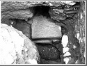
| Exploration resulting from digging of a new cellar at no. 7 Adrianou Street. Wall block of building of Roman times re-used upside down. Behind and to left, some of rubble and mortar foundations. In front, ... AMS north 490 ... 25 Jun 1956 |
| Excavations at the corner of Adrianou Street (no. 7) and Theseion Street (Panathenaic Way). Actual state plan, scale 1:50 (revised from PD 1006 made in 1956) ... John Travlos ... PD 1089 AMS Horizontal (normal) ... 1958 |
| Exploration resulting from digging of a new cellar at no. 7 Adrianou Street. Wall block of building of Roman times re-used upside down. Behind and to left, some of rubble and mortar foundations. In front, ... north 490 ... 25 Jun 1956 |
| Turkish and Byzantine walls in Trench B (Rooms 20, 21, 23, 24, 25, 26, 27, 28, 29, 30, 17, 18). In foreground Turkish level of the Panathenaic Way ... south 812 ... 12 May 1970 |
| Turkish and Byzantine walls in Trench B (Rooms 20, 21, 23, 24, 25, 26, 27, 28, 29, 30, 17, 18). In foreground, Turkish level of the Panathenaic Way ... south 814 ... 12 May 1970 |
| Excavations at the corner of Adrianou Street (no. 7) and Theseion Street (Panathenaic Way). Actual state plan, scale 1:50 (revised from PD 1006 made in 1956) ... John Travlos ... PD 1089 ... 1958 |
| Eastern part of the section near the north bridge showing the line of limestone bases 1 to 5 ... west ... 1974 |
| Panathenaic Way just west of the northern entrance to the Agora.
East Trench and East Extension showing the line of limestone bases 1 to 5; cobbles and road surface, and cuttings for bleachers (ikria) ... Cf. 2011.04.0190 south 3490 Horizontal (normal) ... 1980 |
| East Trench and East Extension line of limestone bases, cobbles and road surface, and cuttings for bleachers (ikria) ... west 3492 ... 1980 |
|
|