icon

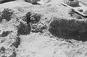
2009.03.0175 (Section ΖΖ 30)

View showing bedrock cleared at foot of modern retaining walls, just before collapse. R indicates place where road gravel was dug. Across foreground, terracotta water main. At right, bedrock somewhat cut ... Scanned 2005 for the 75th anniversary exhibition and publication. 125 Horizontal (normal) ... 30 Mar 1939

icon

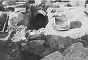
2012.31.0277 (Section ΒΒ 84)

Water Channel C ... AMS 387 Horizontal (normal) ... 30 Mar 1939
icon

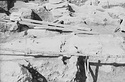
2012.31.0299 (Section ΒΒ 106)

Tile floor ... AMS 386 Horizontal (normal) ... 31 Mar 1939

icon

2012.31.0300 (Section ΒΒ 107)

Tile floor ... AMS 386 Horizontal (normal) ... 31 Mar 1939

icon

2012.31.0301 (Section ΒΒ 108)

Tile floor ... AMS 386 Horizontal (normal) ... 31 Mar 1939

icon

2012.31.0302 (Section ΒΒ 109)

House 648/15. Base of pithos at 49/ΙΘ, under Wall A. Pit at 41/K ... AMS 385 Horizontal (normal) ... 31 Mar 1939

icon

2012.31.0303 (Section ΒΒ 110)

Road cut II looking southeast. A is high stand at west ... AMS 406 Horizontal (normal) ... 1 Apr 1939

icon

2012.32.0802 (Section ΓΓ 105)

Burial at southwest corner of church, looking west. Arrow at left shows south foundation of church. Arrow at right shows west foundation of wall ... AMS 311 Horizontal (normal) ... 30 Mar 1939