icon

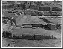
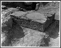
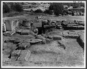
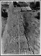
1997.14.0468 (84-597)

Northeast annex of the Fountain House ... south 4288 Horizontal (normal) ... 20 Jul 1966

icon

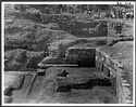
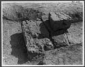
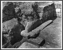
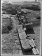
1997.14.0469 (84-608)

Southwest annex of the Fountain House ... south 4289 Horizontal (normal) ... 20 Jul 1966

icon

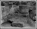
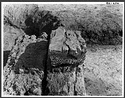
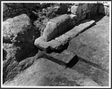
1997.14.0474 (84-599)

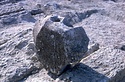
Blocks of the outer stylobate reused in flagging in the northwest corner ... north 4269 Horizontal (normal) ... 20 Jul 1966

icon

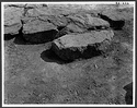
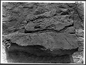
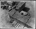
1997.14.0475 (84-602)

Fragmentary block of outer stylobate reused in flagging in the northwest corner ... south 4272 Horizontal (normal) ... 20 Jul 1966

icon

1997.14.0476 (84-603)

Blocks of outer stylobate reused in flagging in the northwest corner ... northwest 4266 Horizontal (normal) ... 20 Jul 1966

icon

1997.14.0477 (84-605)

Fragment of inner stylobate in situ ... southwest 4262 Horizontal (normal) ... 20 Jul 1966

icon

1997.14.0478 (84-606)

Fragment of inner stylobate in situ ... south 4264 Horizontal (normal) ... 20 Jul 1966

icon

1997.14.0479 (85-13)

Fragment of inner stylobate found in place ... west 4517 Horizontal (normal) ... 12 Aug 1966

icon

1997.14.0489 (84-564)

View to show blocks as found in the mouth of the collapsed well ... north 4260 Horizontal (normal) ... 16 Jul 1966

icon

1997.14.0490 (84-565)

View to show blocks as found in the mouth of the collapsed well ... north 4259 Horizontal (normal) ... 16 Jul 1966

icon

1997.14.0491 (84-594)

Northeast corner in the early afternoon light. View of the annex in the center ... north 4286 Horizontal (normal) ... 20 Jul 1966

icon

1997.14.0492 (84-595)

Northeast corner in the late morning light. Northeast annex in the center ... north 4285 Horizontal (normal) ... 20 Jul 1966

icon

1997.14.0493 (84-598)

Late flagging in the northwest corner ... north 4274 Horizontal (normal) ... 21 Jul 1966

icon

1997.14.0494 (84-600)

Junction of the southwest annex with the southwest corner of the main building. View before stripping orthostates in the south wall of the annex ... southwest 4290 Horizontal (normal) ... 21 Jul 1966

icon

1997.14.0495 (84-601)

Junction of the southwest annex with the southwest corner of the main building. View after stripping of orthostates in the south wall of the annex ... southwest 4291 Horizontal (normal) ... 21 Jul 1966

icon

1997.14.0496 (84-604)

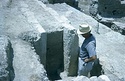
Toichobate with impression of anta in the north wall ... northwest 4287 Horizontal (normal) ... 20 Jul 1966

icon

1997.14.0497 (84-633)

East foundations of the Fountain House ... south 3994 Horizontal (normal) ... 29 Jul 1966

icon

1997.14.0498 (84-635)

North foundations, both original and supplementary ... Neg. number wrong on photo, should be 84-635. west 4002 Horizontal (normal) ... 29 Jul 1966

icon

1997.14.0499 (85-9)

Northwest corner after the removal of the late drain ... south 4509 Horizontal (normal) ... 12 Aug 1966

icon

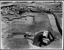
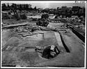
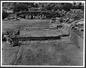
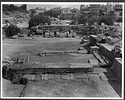
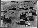
1997.14.0521 (84-588)

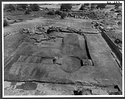
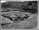
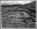
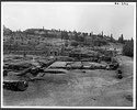
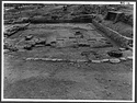
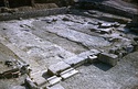
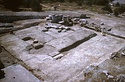
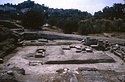
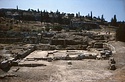
General view after cleaning ... northwest 4276 Horizontal (normal) ... 20 Jul 1966

icon

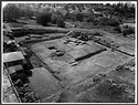
1997.14.0522 (84-589)

General view after cleaning ... north 4282 Horizontal (normal) ... 20 Jul 1966

icon

1997.14.0523 (84-590)

General view after cleaning ... southwest 4277 Horizontal (normal) ... 20 Jul 1966

icon

1997.14.0524 (84-591)

General view after cleaning ... east 4284 Horizontal (normal) ... 20 Jul 1966

icon

1997.14.0525 (84-592)

General view after cleaning ... south 4280 Horizontal (normal) ... 20 Jul 1966

icon

1997.14.0526 (84-593)

General view after cleaning (wide angle lens) ... south 4281 Horizontal (normal) ... 20 Jul 1966

icon

1997.14.0527 (84-596)

General view after cleaning ... west 4283 Horizontal (normal) ... 20 Jul 1966

icon

1997.14.0528 (85-10)

View after clearance of foundation bedding pits ... northwest 4511 Horizontal (normal) ... 12 Aug 1966

icon

1997.14.0529 (85-11)

View after clearance of foundation bedding pits ... southwest 4513 Horizontal (normal) ... 12 Aug 1966

icon

1997.14.0530 (85-12)

View after clearance of foundation bedding pits ... east 4515 Horizontal (normal) ... 12 Aug 1966

icon

2004.01.1611 (HAT 66-155)

Southwest Fountain House ... MAF ... southwest ... 1966

icon

2004.01.1612 (HAT 66-156)

General view after cleaning ... MAF ... northwest ... July 1966

icon

2004.01.1613 (HAT 66-157)

General view after cleaning ... MAF ... west ... 1966

icon

2004.01.1614 (HAT 66-158)

General view after cleaning ... MAF ... south ... July 1966

icon

2004.01.1615 (HAT 66-159)

Fountain parapet of poros, probably from the Southwest Fountain House ... MAF ... 1966

icon

2004.01.1616 (HAT 66-177)

Poros Aqueduct behind the west end of the South Stoa II. Detailed view ... Cf. 84-122 ... 1966

icon

2004.01.1617 (HAT 66-182)

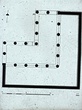
Southwest Fountain House, original plan ... John Travlos ... 1966

icon

2004.01.1618 (HAT 66-183)

Southwest Fountain, parapet, restored ... W.B. Dinsmoor, Jr ... PD 1525 ... 1966

icon

2004.01.1623 (HAT 66-151)

Triangular Shrine at the southwest corner of the Agora, north wall with Boundary Stone I 7012 ... Cf. 85-141 ... 1966

icon

2012.58.1189 (87-496)

Plan, elevation, and sections of the "Heliaia" (now identified as the Aiakeion) and the Water Clock ... W.B. Dinsmoor, Jr ... PD 1516 AMS Horizontal (normal) ... 1966

icon

2012.59.0454 (88-473)

Triglyph. Plan and elevation ... W.B. Dinsmoor, Jr ... PD 1548 AMS Horizontal (normal) ... 1966

icon

2009.03.0442 (Section Κ 539)

Horos (TO HIERO) at northeast corner of Temenos wall, southwest corner of Agora. View from north ... Scanned 2005 for the 75th anniversary exhibition and publication. 4483 Horizontal (normal) ... 2 Sep 1966

icon

2004.01.1759 (HAT 66-134)

General view of the excavated area along the modern road (Asteroskopeiou Street) south of the Agora. West end of the South Stoa II. Cf. nb. p. 4309 ... =photo Κ 507. southwest ... May 1966

icon

2004.01.1912 (HAT 66-154)

Section south of the "Heliaia" (now identified as the Aiakeion) and the Southwest Fountain House. General view of road surface with poros gutter in foreground. The Triangular Shrine at low right corner ... Cf. 85-137 east ... 1966

icon

1997.14.0131 (84-634)

Tributary of the Poros Aqueduct and drawshaft at the west side of the "Heliaia" (now identified as the Aiakeion). For closer view, cf. 1997.14.0125 ... southwest 3993 Horizontal (normal) ... 29 Jul 1966

icon

1997.14.0179 (84-607)

Wall block reused in bedding for 2nd pier from west in the south colonnade of the peristyle ... southeast 3955 Horizontal (normal) ... 21 Jul 1966

icon

1997.12.0246 (88-473)

Triglyph. Plan and elevation ... W.B. Dinsmoor, Jr ... PD 1548 Horizontal (normal) ... 1966

icon

1997.13.0102 (85-142)

Poros stone aqueduct: section south of the southeast corner of the "Theseion" (now identified as the Aiakeion)". Remnants of poros side walls and floor slabs of aqueduct pillaged in Early Byzantine period ... east 4417 Horizontal (normal) ... 3 Sep 1966

icon

1997.13.0125 (85-143)

Ancient poros gutter bordering the south side of the road south of the Agora. Tributary from the south intersecting at this point ... southeast 4455 Horizontal (normal) ... 3 Sep 1966

icon

1997.13.0129 (87-496)

Plan, elevation, and sections of the "Heliaia" (now identified as the Aiakeion) and the Water Clock ... W.B. Dinsmoor, Jr ... PD 1516 Horizontal (normal) ... 1966

icon

1997.13.0291 (85-139)

4th c. B.C. house wall bordering the south side of the ancient South Road (east-west street) ... southwest 4465 Horizontal (normal) ... 3 Sep 1966

icon

1997.13.0313 (84-610)

Section south of the southeast corner of the Southwest Fountain House ... west 4373 Horizontal (normal) ... 26 Jul 1966

icon

1997.13.0314 (84-611)

Section south of the southeast corner of the Southwest Fountain House ... northeast 4375 Horizontal (normal) ... 26 Jul 1966

icon

1997.13.0315 (84-612)

Section south of the southeast corner of the Southwest Fountain House ... north 4377 Horizontal (normal) ... 26 Jul 1966

icon

1997.13.0316 (84-613)

Section south of the Southwest Fountain House. Uppermost ancient road surface ... east 4389 Horizontal (normal) ... 27 Jul 1966

icon

1997.13.0317 (84-614)

Section of the South Road south of the Southwest Fountain House ... south 4391 Horizontal (normal) ... 27 Jul 1966

icon

1997.13.0318 (85-131)

In the center, line of poros gutter with street to right. Some of numerous Byzantine pithoi dug into ancient levels ... west 4437 Horizontal (normal) ... 3 Sep 1966

icon

1997.13.0319 (85-132)

Section south of the "Heliaia" (now identified as the Aiakeion). In foreground 4th c. B.C. settling basin. In background, ancient road surface to right of poros gutter ... west 4423 Horizontal (normal) ... 3 Sep 1966

icon

1997.13.0320 (85-137)

Section south of the "Heliaia" (now identified as the Aiakeion) and the Southwest Fountain House. General view of road surface with poros gutter in foreground ... east 4485 Horizontal (normal) ... 3 Sep 1966

icon

1997.13.0321 (85-59)

Road south of the "Heliaia" (now identified as the Aiakeion) and of the Southwest Fountain House. In the center, remnants of poros gutter disrupted by Byzantine pithoi. To right of gutter, line of 4th ... west 4453 Horizontal (normal) ... 27 Aug 1966

icon

1997.13.0322 (85-60)

Area of the intersection southwest of the Southwest Fountain House. In the center, remnants of poros gutter disrupted by Byzantine pithoi. To right of gutter, line of 4th c. B.C. house walls. In right ... west 4463 Horizontal (normal) ... 27 Aug 1966

icon

1997.13.0409 (85-129)

Triangular Sanctuary at the southwest entrance to the Agora. View showing adjoining block of house wall with poros gutter and road surface to left. Boundary Stone of the Sanctuary in the center of the ... southeast 4477 Horizontal (normal) ... 3 Sep 1966

icon

1997.13.0410 (85-130)

Triangular Sanctuary at the southwest entrance to the Agora. Boundary Stone in situ ... south 4479 Horizontal (normal) ... 3 Sep 1966

icon

1997.13.0411 (85-134)

Triangular Sanctuary at the southwest entrance to the Agora ... southwest 4473 Horizontal (normal) ... 3 Sep 1966

icon

1997.13.0412 (85-135)

Triangular Sanctuary at the southwest entrance to the Agora. Abutting corner is block of late 5th-early 4th c. B.C. house with poros gutter to left ... southeast 4469 Horizontal (normal) ... 3 Sep 1966

icon

1997.13.0413 (85-136)

Triangular Sanctuary at the southwest entrance to the Agora. Abutting corner is block of late 5th-early 4th c. B.C. house with poros gutter to left ... southeast 4471 Horizontal (normal) ... 3 Sep 1966

icon

1997.13.0414 (85-141)

Triangular Sanctuary at the southwest entrance to the Agora. North wall of Sanctuary, with Boundary Stone exposed ... south 4475 Horizontal (normal) ... 3 Sep 1966

icon

1997.13.0415 (85-144)

Triangular Sanctuary at the southwest entrance to the Agora. Boundary Stone in situ ... south 4481 Horizontal (normal) ... 3 Sep 1966

icon

1997.13.0417 (85-359)

Triangular Sanctuary at the southwest entrance to the Agora. East half of the north wall with Boundary Stone ... south 4934 Horizontal (normal) ... 10 August 1966

icon

2012.37.0107 (Section Κ 539)

Horos (TO HIERO) at northeast corner of Temenos wall, southwest corner of Agora. View from north ... AMS 4483 Horizontal (normal) ... 2 Sep 1966

icon

2012.57.0504 (84-564)

View to show blocks as found in the mouth of the collapsed well ... AMS north 4260 Horizontal (normal) ... 16 Jul 1966

icon

2012.57.0505 (84-565)

View to show blocks as found in the mouth of the collapsed well ... AMS north 4259 Horizontal (normal) ... 16 Jul 1966

icon

2012.57.0529 (84-588)

General view after cleaning ... AMS northwest 4276 ... 20 Jul 1966

icon

2012.57.0530 (84-589)

General view after cleaning ... AMS north 4282 ... 20 Jul 1966

icon

2012.57.0531 (84-590)

General view after cleaning ... AMS southwest 4277 ... 20 Jul 1966

icon

2012.57.0532 (84-591)

General view after cleaning ... AMS east 4284 ... 20 Jul 1966

icon

2012.57.0533 (84-592)

General view after cleaning ... AMS south 4280 ... 20 Jul 1966

icon

2012.57.0534 (84-593)

General view after cleaning (wide angle lens) ... AMS south 4281 ... 20 Jul 1966

icon

2012.57.0535 (84-594)

Northeast corner in the early afternoon light. View of the annex in the center ... AMS north 4286 ... 20 Jul 1966

icon

2012.57.0536 (84-595)

Northeast corner in the late morning light. Northeast annex in the center ... AMS north 4285 ... 20 Jul 1966

icon

2012.57.0537 (84-595bis)

Northeast corner in the late morning light. Northeast annex in the center ... AMS north Horizontal (normal) ... 20 Jul 1966

icon

2012.57.0538 (84-597)

Northeast annex of the Fountain House ... AMS south 4288 ... 20 Jul 1966

icon

2012.57.0539 (84-596)

General view after cleaning ... AMS west 4283 Horizontal (normal) ... 20 Jul 1966

icon

2012.57.0540 (84-598)

Late flagging in the northwest corner ... AMS north 4274 ... 21 Jul 1966

icon

2012.57.0541 (84-599)

Blocks of the outer stylobate reused in flagging in the northwest corner ... AMS north 4269 ... 20 Jul 1966

icon

2012.57.0542 (84-600)

Junction of the southwest annex with the southwest corner of the main building. View before stripping orthostates in the south wall of the annex ... AMS southwest 4290 ... 21 Jul 1966

icon

2012.57.0543 (84-601)

Junction of the southwest annex with the southwest corner of the main building. View after stripping of orthostates in the south wall of the annex ... AMS southwest 4291 ... 21 Jul 1966

icon

2012.57.0544 (84-602)

Fragmentary block of outer stylobate reused in flagging in the northwest corner ... AMS south 4272 ... 20 Jul 1966

icon

2012.57.0545 (84-603)

Blocks of outer stylobate reused in flagging in the northwest corner ... AMS northwest 4266 ... 20 Jul 1966

icon

2012.57.0546 (84-604)

Toichobate with impression of anta in the north wall ... AMS northwest 4287 ... 20 Jul 1966

icon

2012.57.0547 (84-605)

Fragment of inner stylobate in situ ... AMS southwest 4262 ... 20 Jul 1966

icon

2012.57.0548 (84-606)

Fragment of inner stylobate in situ ... AMS south 4264 ... 20 Jul 1966

icon

2012.57.0549 (84-607)

Wall block reused in bedding for 2nd pier from west in the south colonnade of the peristyle ... AMS southeast 3955 ... 21 Jul 1966

icon

2012.57.0550 (84-608)

Southwest annex of the Fountain House ... AMS south 4289 ... 20 Jul 1966

icon

2012.57.0552 (84-610)

Section south of the southeast corner of the Southwest Fountain House ... AMS west 4373 ... 26 Jul 1966

icon

2012.57.0553 (84-611)

Section south of the southeast corner of the Southwest Fountain House ... AMS northeast 4375 ... 26 Jul 1966

icon

2012.57.0554 (84-612)

Section south of the southeast corner of the Southwest Fountain House ... AMS north 4377 ... 26 Jul 1966

icon

2012.57.0555 (84-613)

Section south of the Southwest Fountain House. Uppermost ancient road surface ... AMS east 4389 ... 27 Jul 1966

icon

2012.57.0556 (84-614)

Section of the South Road south of the Southwest Fountain House ... AMS south 4391 ... 27 Jul 1966

icon

2012.57.0575 (84-633)

East foundations of the Fountain House ... AMS south 3994 ... 29 Jul 1966

icon

2012.57.0576 (84-634)

Tributary of the Poros Aqueduct and drawshaft at the west side of the "Heliaia" (now identified as the Aiakeion). For closer view, cf. 1997.14.0125 ... AMS southwest 3993 ... 29 Jul 1966